 |
|
|
|
|
|
|
|
|
|
|
|

Click on photo to view the original size. |
| Viewers
|
|
|
|
|
|
|
|
|
|
|
Read what others had to say:
|
|
|
|
|
|
|
 |
Don Maxwell - Feb 11,2020
Viewers
| Reply
|
| |
As in the upper image, a native bark, fashioned from one single massive tree trunk floats on the waves, en route to Portugal. Or perhaps to Spain--who knows the vagaries of the Gulf Stream as it sweeps majestically around the northern Atlantic, past Labrador, Greenland, Iceland, the United Kingdom, and France to the Iberian Peninsula, before it finally swings westward again near the equator? Who, indeed?
Here on the ancient James River, there are rarely clouds low enough for the tops of the islands to rise above the murk. But today is a special day, and conditions are just right.
I was able to capture the fleeting moment from my vantage on the rolling deck of the TajMahouse, high above the roiling waters, as I peered at the islands' massive tops, rising perhaps as high as thirty feet Mean Sea Level.
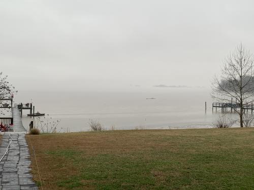
IMG_7488
| | |
|
Don Maxwell - Feb 11,2020
Viewers
| Reply
|
| |
The clouds moved away from the infamous Buzz Island, so named because for some sixty years the peninsula now home to the TajMahouse harbored an aerodrome and seaplane base called Hopewell Airport, where many civilian and (during the Second World War) U.S. Army pilots learned to fly. Buzzing was probably optional.
The far shore, beyond Buzz Island and the main shipping channel, is about 1.5 nautical miles distant. The river is wide. But a few miles downstream it narrows to 0.22 nautical miles--about 1300 feet, hardly half the distance to Buzz Island--and is 90 feet deep.
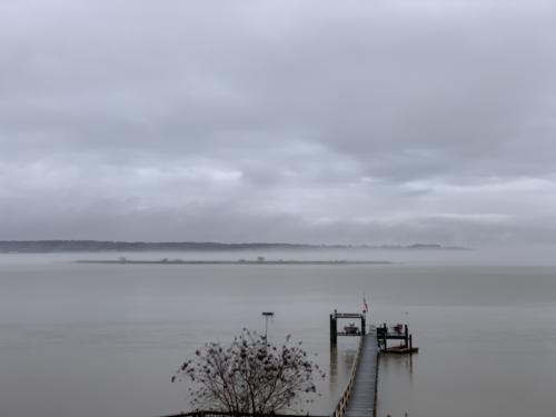
IMG_7497
| | Attachments:

Hopewell Airport
| | |
|
Nickens, Dan - Feb 11,2020
Viewers
| Reply
|
| |
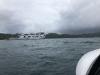
Mythical south sea islands, Don? Really. It is your photos that have a mystical, surreal quality.
But just to show that south sea islands can appear just as shady, here is a view from the Searey this
past weekend where Tulaghi Harbour in the Solomon Islands is just as shady. At least you can see the
island unlike a few moments before when rain from a cyclone in Vanuatu obscured everything.
| | Attachments:
ECD5D984-A3B0-4610-9870-C511C198D403
| |
| Attachments:

7C549FA4-DFBA-43CA-BDE9-865C61038166
| | |
|
Ken Leonard - Feb 11,2020
Viewers
| Reply
|
| |
Don, your first paragraph sounds rather Kipling-esq. “round the great, grey, green, greasy, Limpopo River, all set about
with fever treesâ€
| | |
|
Don Maxwell - Feb 12,2020
Viewers
| Reply
|
| |
By early evening the clouds were obscuring the supports for the Benjamin Harrison Memorial Bridge, which has a vertical-lift span of 360 feet. The bridge is about 1 statute mile NNW of the TajMahouse's present position on the south bank of the James and the east shore of Jordan Point. No fever trees are in evidence.
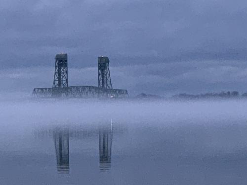
IMG_7942
| | |
|
|
|
|
|
|
|
|
|
|