 |
|
Photos
View |
|
All Photos |
Add Photos |
Emoticons |
Album View |
Mark Unread
|
|
|
|
|
|
|
|
|
|
|
|
|
|
|
|
|

Click on photo to view the original size. |
| Viewers
|
|
|
|
|
|
|
|
|
|
|
Read what others had to say:
|
|
|
|
|
|
|
 |
Don Maxwell - Jul 19,2017
Viewers
| Reply
|
| |
Keith's runway is 2400 feet long, but Peter's Searey didn't use much of it to take off:
(If the video won't play on your Mac, try downloading it and then playing it.)
| | Attachments:

Magnuson Takeoff
| | |
|
Don Maxwell - Jul 19,2017
Viewers
| Reply
|
| |
I flew west with him in my own Searey, up the James River and toward the Shenandoah Valley.
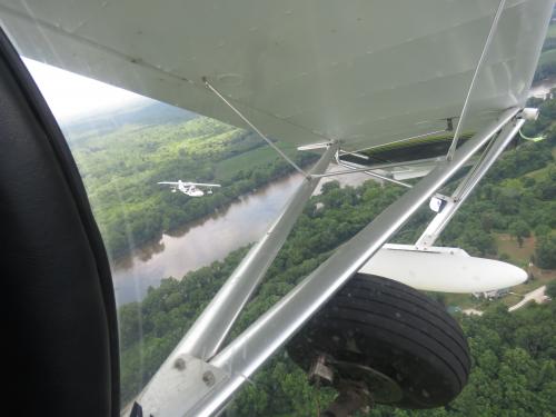
IMG_0729-PeterOnWing-Turn.JP
| | |
|
Don Maxwell - Jul 19,2017
Viewers
| Reply
|
| |
The Valley is separated from the piedmont by the first line of the Appalachian Mountains. We had to climb to about 4,000 MSL to clear them.
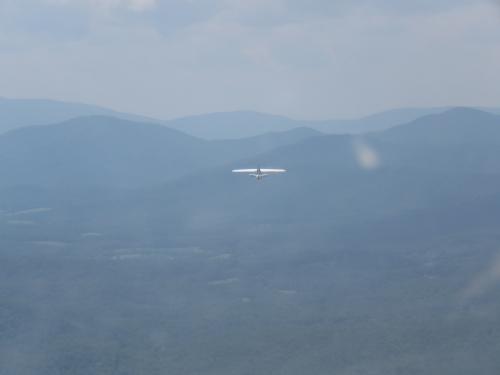
IMG_0762-Peter-Trail_Mts.JP
| | |
|
Don Maxwell - Jul 19,2017
Viewers
| Reply
|
| |
Interstate 64 winds through a cut in the mountains.
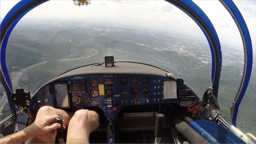
1-I64
| | |
|
Don Maxwell - Jul 19,2017
Viewers
| Reply
|
| |
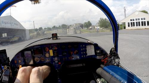
Close beside I-64 is W13 (Eagle's Nest airpark), where Peter's uncle lives.
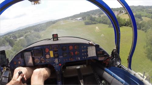
2-EaglesNestFinal
| | |
|
Don Maxwell - Jul 19,2017
Viewers
| Reply
|
| |
I said hello to Peter's uncle, added some gas, said goodbye to them both, and prepared to head back east, over the ridges and down to Flatland.
3-EaglesNestRamp
| | |
|
Don Maxwell - Jul 19,2017
Viewers
| Reply
|
| |
After taking off, I discovered that there were a few problems down on Flatland, including storms that were closing in on me from three sides, as you can see in this photo of Garmin Pilot's display on my iPhone. (The course line there was an experiment. I was actually going elsewhere.) There were a couple of other problems, too, but I made it home just fine, a good five minutes ahead of the rain.
| | Attachments:
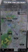
Radar-Storms
| | |
|
|
|
|
|
|
|
|
|
|
|
| |
- About Searey.us -
- Contact Searey.us -
|
- Privacy Statement -
- Terms of service -
|
Copyright © 2024 Searey.us & Brevard Web Pro, Inc. -
Copyrights may also be reserved
by posters and used by license on this site. See Terms of Service for more information.
|
| |
- Please visit our NEW
Chapter Place Website at: chapterplace.com or
Free Chapter Management Website at: ourchapter.org. Good for all chapters, groups or families. |
| | |