|
|
 |
|
|
|
|
|
|
|
|
|
|
|
|
|

Click on photo to view the original size. |
| Viewers
|
|
|
|
|
|
|
|
|
|
|
Read what others had to say:
|
|
|
|
|
|
|
 |
Dan Nickens - Dec 16,2011
Viewers
| Reply
|
| |
Oklahoma is home on the range for cattle. There is lots of space for a nice lawn and swimming pool. That’s because of a population decline among their bipedal neighbors. It’s gotten so bad that they are closing the local school in Yuba after more than 80 years.<br /><br />One of the locals, Jeff, wasn’t happy about it and said so: “After serving children for decades at the school, currently an Elementary School site in Yuba, OK, 'Where the Sun Kisses the Earth Every Morning', is closing. This is sad but a sign of the current economic situation across our nation in education funding brought about over the past several years. My father was a Bus Driver, Teacher, Coach, Principal and Superintendent of in this system for about 32 years in the past. The faculty and support staff have served our children and families well through the years.”<br /><br />Jeff was nowhere in sight when Pia and I flew over. Somewhere out there on the convoluted plain is at least one man who thinks the kids should be “the top priority.”<br /><br />They should have thought about that before changing the town’s name from Karma to Yuba. Yuba? Yuba (def.): Soybean milk “skin” that forms when the milk is heated. How is a kid supposed to think they are a priority when their town means milk skin? In their defense, the residents really wanted to live in “Eagle Lake.” A kid could probably grow up happy in Eagle Lake. A kid from Eagle Lake could easily grow up to find success as a SeaRey pilot. I’m a lot less optimistic about the soy milk skin kids.<br />
| | Attachments:

Home on Range
| | |
|
Dan Nickens - Dec 16,2011
Viewers
| Reply
|
| |
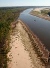
Just north of Telephone, Texas, the Red River cut a sharp bank. Me and Pia decided to follow the river’s course due east instead of overflying the town.<br /><br />The town is probably used to such disrespect. When Pete Hindman tried to open a post office in his general store he proposed a lot of different names. Unfortunately all he proposed to the post office were already taken. Finally he was struck by inspiration: his general store had a telephone in it. In the late 1880’s that was a big deal. That, and the fact that no one else had thought of “telephone” as a town name, made if official: Telephone, Texas.<br /><br />The first long distance line was run from French Corrall to Bowman Lake at the head of the Yuba River (in California) in 1877. If local historians are correct, it didn’t take long to get a line to Oklahoma. And they might have used barbed wire as transmission line. In the 1890s that was a rural transmission media for party lines. <br />
| | Attachments:

Cut Banks
| | |
|
Dan Nickens - Dec 16,2011
Viewers
| Reply
|
| |
Green and brown and sharply divided. Is that the way it is in Arthur City? Maybe. Most of the residents are part time farmers and work a real job in Paris (Paris, Texas, that is). Part time farming is hard. A rumor made up from SeaRey altitude has Skeeter finally giving up and moving to Paris. Unfortunately Skeeter’s wife of 11 years, Sally, doesn’t want to move into the city. Their 1500 square foot house sits on 26 acres just off the county road. It has either 2 or 3 or 5 bathrooms depending on how many blanks Skeeter’s real estate agent buddy, Buddy, filled in on the confusing electronic form. (He would have fixed it but when he tried to go back it dumped him out of the system.) No mention is made in the messy listing of Sally’s large blue above ground pool. That’s a sore point because not only did Skeeter have to mow 26 acres after working all week, he had to clean the pool, which he is quick to point out, he never uses. Sally counters that he always throws his used towels on the bathroom floor where she has to pick them up and that doesn’t help her sore back. The house has been on the market for six months. Buddy says it might sell if Sally would just clean it up before he brings a client to show it. Sally says Buddy hasn’t called even once to show the house. For $169,000 a buyer could settle this argument. Skeeter says he might take less.
| | Attachments:

Divided Pond
| | |
|
Dan Nickens - Dec 16,2011
Viewers
| Reply
|
| |
The meandering river made a completely cutoff loop island near Albion, Texas. That’s perfectly appropriate because Albion is an old name for the island of Great Britain. In “Albion’s Seed” historian David Fischer argues that the Southern “culture of honor” developed in the anarchic environment of the border lands of the southern highlands of the Great Britain. The “warrior” culture was transplanted to Appalachia in one of the four great migrations to the U.S. That’s why the Hatfields and McCoys were bound to tangle (see “Outliers: the Story of Success” by Malcomb Gladwell). Maybe that’s why one Red River County resident, Gavin Watson, Jr., got a Distinguished Flying Cross with Oak Leaf Cluster in WWII for flying B-17s over Germany. After the war he came back to be a judge for 22 years, as well as a local newspaper editor and mayor of nearby Clarksville.
| | Attachments:

Water Loop
| | |
|
Dan Nickens - Dec 16,2011
Viewers
| Reply
|
| |
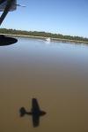
Just outside of Harris, Oklahoma, I started looking for a landing lane in the shallow sandy river bed. It may have been early in the day, but in a dry country you have to take a good splash when you can get.
| | Attachments:
Landing Alignment
| | |
|
Dan Nickens - Dec 16,2011
Viewers
| Reply
|
| |
The nice thing about landing in a shallow river is that the obstacles are clearly visible. Among the many hazards of landing in a shallow water body, the risk of running over an alligator in Oklahoma didn’t generate high anxiety for me. That’s not to say it couldn’t happen. Back in May of 1866 Henry Harris not only was dealing with a flooding river, he had to face up to an alligator. From his diary, “Returned on the mornig of the 9 & left my famly at Little John, Willy & myself swam the B L Sloo and reched Home. Sent our Horses out by freedman. Killone alagater.”<br /><br /><br />You don’t believe it? Well, consider that Judge Henry Churchhill Harris was a prominent jurist in McCurtain County, a Choctaw leader and diplomat who established a ferry across the Red River before the Civil War. He might not have been a student of the spelling arts, but surely a judge wouldn’t make up a story about an alagater.<br /><br /><br />No, Henry Harris was a good man by all accounts. During the depression he never turned people away from his general store when they couldn’t pay. In fact, he burned his credit book when he realized that most of his clients would never be able to pay him.<br /><br /><br />That’s not to say he wasn't susceptible to a bit of delusion. His grandchildren tell the story of his being bushwhacked by his own bullets. He usually shot his hogs when the time came to butcher, so he carried bullets in his coat pocket right beside his tobacco. One night he filled his pipe and started to smoke it. Unfortunately one of the bullets from his pocket got in his pipe. It exploded. Thinking someone was shooting at him he yelled, “Effie, we have been bush whacked.” The next morning he and his wife searched all around the window to find a place a bullet might have entered. Imagine his chagrin when Effie figured out what had happened.<br /><br /><br />Maybe Henry was a little bit crazy, but after the bullet incident he surely wouldn’t have made up an alligator story without some incontrovertible evidence!<br />
| | Attachments:
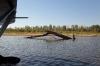
Obvious Obstacle
| | |
|
Dan Nickens - Dec 16,2011
Viewers
| Reply
|
| |
The meandering river has some elaborate patterns in the shallows. Not so far away from the rippled river, Hoss Cartwright is buried. Hoss was born Bobby Dan Blocker in DeKalb, TX. I watched many episodes of ol’Hoss riding across the west on “Bonanza”. He was big, dumb and lovable on TV. In the alternate reality of “real life” he was the only cast member with a graduate degree.
| | Attachments:

Back Bar Ripples
| | |
|
Dan Nickens - Dec 16,2011
Viewers
| Reply
|
| |
Who knows why a meandering river flows one way or the other only to end up in the same place? The guiding principle for Hoss’ character on Bonanza was, 'We shall pass this way on Earth but once, if there is any kindness we can show, or good act we can do, let us do it now, for we will never pass this way again.' Bobby Dan Blocker was a Korean War veteran who so opposed the Vietnam War that he moved his family to Switzerland. After his death, his TV brother described him this way: '…he was so easy to get to know - the kind of guy you could go and have a beer with.' He was the kind of guy who drove a 1965 Chevrolet Chevelle. Hoss must have been a good act.
| | Attachments:

Flow Paths
| | |
|
Dan Nickens - Dec 16,2011
Viewers
| Reply
|
| |
A band of green was woven between the sand and the water. It always amazes me how many intricate patterns appear below when you’re low and slow enough to notice.
| | Attachments:

Braided Bank
| | |
|
Dan Nickens - Dec 16,2011
Viewers
| Reply
|
| |
After leaving Oklahoma, the Red River makes the border for Texas with Arkansas. Having never splashed the Red River in Arkansas, the opportunity couldn’t be passed up. Well, actually, I suppose I had done it before, but I didn’t remember, so it’s the same thing. Or at least I’m saying it doesn’t invalidate the excuse.
| | Attachments:

Red in AR
| | |
|
Dan Nickens - Dec 16,2011
Viewers
| Reply
|
| |
Armored vehicles covered acres of concrete at the Red River Army Depot. The base is primarily responsible for refurbishing Bradley Fighting Vehicles and Multiple Launch Rocket Systems.<br /><br />The official RRAD site touts the old fashion east Texas hospitality and friendly surrounding community. But what do the neighbors from Hooks really think? Well, to quote Sunni Cranfill, 2003 Miss Texas, Dallas Mavericks and Cowboys Cheergirl, “….it is still my favorite place in the world.” <br /><br />Her sunny view is not a universal sentiment. In a Texarkana forum, Beckyhe32 has this to say: 'I am afraid that Hooks is going down if we what have found out what that place then we wouldn't have moved over there. 'It was a quiet little town but nothing to do over there. 'I tried to make friends but they were to good.' I already knew people are bigots.' We would have live in Hooks for 22 years but it will always be small minded. 'We have been living in trailor thats already fallen apart.'I tried to find work but they don't hire anybody who is different.' I used to go to the library alot but now they were never open.' They always sell bad gas but only person who sells it who used to run a convience store before it tasty house. 'Every eaten place we used to go to are being recalled were they had a bunch lazy idiots who don't never like to business with you.' Last trailor park we live in who owned by High fluent landlady who works at the library. 'It seems like she doesn't even care about that place she rents it to troublemakers and drug addicts. 'My niece who is 6 could not catch the bus over there because the lousy noisy nieghbors spiteful grandaughter who picks on her. 'My folks and I don't feel safe over. 'The poor excuse landlady likes trouble makers and drug addicts too.' And so its that no good police officer name Horn.' When your life is threatened no one wants to protect you.' You can't breath,no freedom and no protection.'The people who runs the furniture place who has lots of money and wealth.'They rent slum trailor and houses to the low class people but they don't believe in fixing nothing. 'Hooks is nothing but a bunch of hypocrite town and so its that no good landlady is nothing but a ripoff bitch.'<br /><br />How to explain such a difference in perspective? Well, many of the neighbors work at the Depot, so they probably are happy about that. Sunni grew up on a dairy farm outside of Hooks. Becky moved into town and lived in a trailer park. It’s not an explanation, just an observation. (I lived in two trailer parks, one of which kicked me out, and neither were happy places…though I was. So while I’m kinda sympathetic to Becky’s view, I like Sunni’s better.)<br />
| | Attachments:

Sunni's Site
| |
| Attachments:
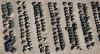
Heavy Metal Lines
| | |
|
Dan Nickens - Dec 16,2011
Viewers
| Reply
|
| |
Each and every one has a story that could be told. Nights parked out in the cold and sleet of a NATO base in Germany. Days baking in the hot desert sun near some Iraqi village. Fortunately the Army has it all in the files of paperwork that follow them around. The problem is that it is all coded without the thousands of individually momentous details.
| | Attachments:

Untold Stories
| | |
|
Dan Nickens - Dec 16,2011
Viewers
| Reply
|
| |
A field full of hummers awaiting……what? What’s next? Iran? Syria? Mexico? Arizona?
| | Attachments:
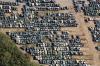
Hummer Collection
| | |
|
Dan Nickens - Dec 16,2011
Viewers
| Reply
|
| |
Storage areas for munitions used in WWII, Korea and Vietnam still line up in the piney woods. The base is now closed but the bunkers remain. Maybe they make good homes for the local rabbits.
| | Attachments:

Bunkered Down
| | |
|
Dan Nickens - Dec 16,2011
Viewers
| Reply
|
| |
This used to be Lake Texarkana. It was renamed the Wright Patman reservoir in honor of a long time Texas congressman. Back in the 1970’s Congressman Patman’s committee started the investigation into the Watergate Scandal. Then, in grilling the Fed Chairman, he asked: “Can you give me any reason why you should not be in the penitentiary?” The Fed Chairman, Arthur Burns, had a particularly unsuccessful reign, believing the country would never accept 6% unemployment, he saw inflation rise to 12% to avoid any such unrest. Chairman Burns blamed Nixon, saying he had to go along with the easy credit policy advocated by the president because otherwise the Fed might lose its independence (or, we have to do what you say otherwise we can’t say we do what we want).<br /><br />Old Congressman Patman served until he was thrown out of his chairmanship by some young rebel for being old and ineffective at the age of 81. He died a year later. Small wonder the lake, fed by the Sulfur River, is shallow, muddy and uninviting. Maybe they should have stuck with “Lake Texarkana.”<br />
| | Attachments:

Dirt Bridge
| | |
|
Dan Nickens - Dec 16,2011
Viewers
| Reply
|
| |
Why water stacks of tree trunks? The theory is that sprinkling reduces available oxygen and minimizes sapwood staining and decay, allowing for longer storage time.
| | Attachments:

Pickup Trunks
| | |
|
Dan Nickens - Dec 16,2011
Viewers
| Reply
|
| |
There’s nothing like a good wastewater treatment pond at a pulp plant for producing aquatic industrial art forms.
| | Attachments:

Art of Waste
| | |
|
Dan Nickens - Dec 16,2011
Viewers
| Reply
|
| |
It’s shallow. It’s the Sulfur River.
| | Attachments:

S Shallow
| | |
|
Dan Nickens - Dec 16,2011
Viewers
| Reply
|
| |
The chart showed a river. That should be a good thing for a SeaRey flight path. Reality was a swamp full of trees. A water landing would require squeezing in between some big and closely spaced obstacles. Occasionally, however, there was an opening that offered little hope of a smooth touchdown.<br /><br />And after a bumpy touchdown, one would have to contend with the Fouke Monster. Lurking somewhere out in the swamp is an ape like creature 10’ tall with a broad chest and fiery red eyes the size of silver dollars. Lending to the credibility of reported sightings is the horrible smell associated with the three toed creature. You can’t expect anything from Sulfur River to smell like a flower.<br /><br />The creature was the subject of several films: The Legend of Boggy Creek, Return to Boggy Creek, Boggy Creek II - The Legend Continues. In 2010 “Boggy Creek” returned with a movie about five kids getting lost in the swamp with a Bigfoot like beast.<br /><br />Reality, however, is even scarier. The local sheriff had to enforce a ban on guns when a Little Rock radio station offered a $1090 reward for shooting the monster in 1971. Then he fined three people $59 for filing “fraudulent monster reports” (apparently that’s a crime in Arkansas).<br />
| | Attachments:

Sparse Swamp
| | |
|
Dan Nickens - Dec 16,2011
Viewers
| Reply
|
| |
At the confluence of the Sulfur River and the Red River, there is a double crossing: power lines and bridge.
| | Attachments:

Double Crossing
| | |
|
Dan Nickens - Dec 16,2011
Viewers
| Reply
|
| |
Out in the shallow river there was an abandoned aid to navigation. It wasn’t much aid to either boats or SeaReys, actually.<br /><br />Maybe it really wasn’t a channel marker or aid to navigation. The river is considered to be intermittent a few miles north (west of Texarkana where the river makes a radical turn). Until the 19th century the river was blocked off to the south by the “Great Raft” or a logjam of tree trunks. The logjam extended more than 160 miles. One Captain Shreve started clearing it out in the 1830’s but didn’t make much progress until dynamite became available in 1870’s. For his pioneering effort, however, Capt. Shreve got his name attached to the town of Shreveport, LA.<br /><br />An unforeseen consequence of clearing the logjam was that the Atchafalaya River moved rapidly to capture the Mississippi’s flow. The Corpse of Engeeners then managed to get involved by building the expensive Old River Control Structure.<br /><br />Dynamite cleared the way north to Natchitoches. In the 20th century a local lobbyist managed to convince the U.S. Congress to fund locks and dams so that barges could make it up to Shreveport. <br /><br />Unless the river has flowed backward recently, however, I can’t see the justification for putting such a big marker in for Billy Bob’s airboat.<br />
| | Attachments:

NavAid
| | |
|
Dan Nickens - Dec 16,2011
Viewers
| Reply
|
| |
Pretty little balls of grass sprouted on the river banks. Not far away in Plain Dealing, there is a sprouting of civic pride, as articulated by Charlie: “we have great people here if you live right and obay the laws you cant find a better place to live the only ones that complain or the law breakers thank god for our little comunity and our law inforcement as you know you cant please every one so obay the law and live like you supose to god bless plain dealing love my town”<br /><br />Not everyone agrees. “Just d way it is” told Charlie, “U got a pathological liar n thief for a mayor n a drunk for a Marshall wake up” I’ll bet Charlie thinks that he must not be obaying the law or living like he’s supposed 2.<br />
| | Attachments:

Green Balls of Grass
| | |
|
Dan Nickens - Dec 16,2011
Viewers
| Reply
|
| |
The irregular shoreline would make a great place for SeaRey beachings.
| | Attachments:

Bumpy Banks
| | |
|
Dan Nickens - Dec 16,2011
Viewers
| Reply
|
Dan Nickens - Dec 16,2011
Viewers
| Reply
|
| |
Count ‘em.<br /><br />Not far from the river Kevin Dumas got arrested for attempted arson. All Kevin did was shoot off a roman candle. Unfortunately it landed across the street in a young pine plantation. It didn’t start a fire, but someone worried that it would.<br /><br />They turned Kevin in to a Forestry Enforcement Officer. The FEO enforced some forest protection by putting the fireworking scoundrel Kevin in handcuffs. <br /><br />'Northwestern Louisiana has been under exceptional drought conditions for some time and it doesn't take much to ignite a wildfire,' Agriculture and Forestry Commissioner Mike Strain said. 'So far wildfire damage in Louisiana has been limited but it would only take the action of one misguided person to set a fire that could burn homes and businesses.'<br /><br />It cost the misguided Kevin $50,000 bail to get out pending his prosecution as a droughtful pyromaniac.<br />
| | Attachments:

Three Bridges
| | |
|
Dan Nickens - Dec 16,2011
Viewers
| Reply
|
| |
It was once on the bottom of a lake, but before that it was on the bottom of a stream. The earthen dam built back in 1975 obscured the stream in a flood of water until the drought brought it back. Since it is an artificial lake, it is artificially governed by the Cypress Black Bayou Recreation and Water Conservation District for Bossier Parrish. They have a specific “public safety” rule that prohibits flight of all Ultra-Light aircraft under five hundred feet altitude on both the Cypress and Black Bayou Reservoirs. As a gesture of solidarity with such aircraft I boycotted the lake and maintained an altitude of 501’.
| | Attachments:

Almost Lakebottom
| | |
|
Dan Nickens - Dec 16,2011
Viewers
| Reply
|
| |
Just before the airport at Minden trees lined up on old mine rows. Minden was the lunch stop of the day. An old courtesy car provided transportation into town. Minden looked like a nice little southern town whose fame counts among its credentials the marriage place for Hank Williams (the senior). He died three months later while on a car trip. His widow, Billie Jean, then married Johnny Horton. He died a few years later in a car accident and is buried in another small town in the same parish.<br /><br />It took 3 hours to cover the 222 miles to Minden (KMNE) clocking a mundane 74 mph on average. Photos dropped to 228 or, right at 1 photo per mile.<br />
| | Attachments:

Mine Bottoms
| | |
|
Dan Nickens - Dec 16,2011
Viewers
| Reply
|
| |
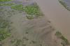
A dredge could be seen working a sand mine near Dubberly, Louisiana. A Dubberly resident, Army Spc. Joshua A. Tomlinson was killed in a May 18, 2010 suicide car bomb blast in Afghanistan. Maybe a friend of his father operates the dredge, spilling an orange stain upon the blue water.
| | Attachments:

Water Coloring
| | |
|
Dan Nickens - Dec 16,2011
Viewers
| Reply
|
| |
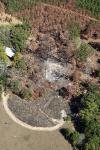
A fire in a lonely house out in the middle of the piney woods is a monstrous thing. And it happened on “God’s Front Porch” according to the official web site of Mt. Lebanon, Louisiana.
| | Attachments:
Burned Out
| | |
|
Dan Nickens - Dec 16,2011
Viewers
| Reply
|
| |
Keeping the wood wet is just one of the things young FFA members must learn to compete in the Forestry Career Development Event. The competition allows students to demonstrate their knowledge in tree ID, map reading, saw timber estimation, pulpwood estimation, compass and pacing, and timber stand improvements. Four local guys, Leyton, Dustin, Alexis and Dylon won first place in the state competition back in August. Their unhappy faces appeared in the local newspaper as it proudly proclaimed, “Now it’s on to the nationals.” They should use the circular wood pile as a natural stadium. They could dodge the high pressure sprinkler as they calculate their estimations. I’m guessing that would raise awareness of the sport.
| | Attachments:

Spraying Wood
| | |
|
Dan Nickens - Dec 16,2011
Viewers
| Reply
|
| |
After being stuck out over the piney woods for too long, I decided on a detour along a river: the Dugdemona (“Dug-duh-mona”) River. It didn’t offer any improvement over the piney woods for emergency landings, but I liked its name. It has also been called:<br />Bugdemon River<br />Degdemoa Creek<br />Dogdamane River<br />Dogdemane River<br />Dogdimona River<br />Dougdiamonia Bayou<br />Duagdemonai Bayou<br />Ducdumani Creek <br />Duedumani Creek<br />Dug de Mona Bayou<br />Dug de Mona River<br />Dugdamoney River<br />Dugdamoni River<br />Dugdamonia Bayou<br />Dugdamonia Creek<br />Dugdamony River <br />Dugdemona Bayou<br />Dugdemoni Creek<br />Dugdimona River<br />Dugdimoni Bayou<br />Dugdymonia Creek<br />Dugmonia Bayou<br />Dugdemonia River<br />Little River<br /><br />My personal favorites are “Ole Duggie” or, simply, “The Dug”.<br />
| | Attachments:

Unsuitable for Seaplanes
| | |
|
Dan Nickens - Dec 16,2011
Viewers
| Reply
|
| |
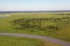
The lake was pretty shallow and the old stream bed was easy to see. Catahoula Lake and the associated National Wildlife Refuge, have been deemed a Globally Important Bird Area. Catahoula Lake is also recognized as a “Wetlands of International Importance”.<br /><br />Water level is artificially manipulated to produce “the ultimate habitat for waterfowl.” The lake is dewatered beginning July 1, to facilitate the growth of wetland vegetation. The lake shrinks from 26,000 acres to a 5,000 acre “conservation pool” throughout the summer. Ten to fifteen days prior to waterfowl hunting season the<br />Water level is raised two feet to provide habitat for migratory waterfowl (the “targets”). After the season, the water level is raised another four and a half feet for commercial fishermen.<br /> <br />Before the level was managed, the lake fluctuated in concert with local rainfall and back flooding from the Red, Black and Mississippi Rivers.<br /><br />Almost 10,000 acres within the Wildlife Refuge have been “reforested” in conjunction with a carbon sequestration project sponsored by a utility company, American Electric Power.<br />
| | Attachments:
River Overflow
| | |
|
Dan Nickens - Dec 16,2011
Viewers
| Reply
|
| |
The lake level may have been low, but the channel offered a seaplane break. The lake isn’t mentioned in the Seaplane Pilots Association landing guide. That’s probably because not too many seaplanes would consider the possibility.
| | Attachments:
Lowered Lake
| | |
|
Dan Nickens - Dec 16,2011
Viewers
| Reply
|
| |
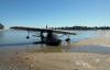
The Black River only flows for 40 miles. It starts as the Ouachita and merges into the Red River. Going with the theory that every major water body should be visited by SeaReys, Pia took the plunge near New Era.
| | Attachments:

Down On the Black
| | |
|
Dan Nickens - Dec 16,2011
Viewers
| Reply
|
| |
It’s hard to pass up such a conveniently located bar, especially when it is conveniently located on the majestic Mississippi River.
| | Attachments:

Inviting Bar
| | |
|
Dan Nickens - Dec 16,2011
Viewers
| Reply
|
| |
At rest on a small cove behind the sandbar Pia looked right at home. (For a vagabond without a family of her own, any place can be home.)<br /><br />Not far from Pia’s resting spot was the small town of Ft. Adams, MS. The man without a country chose Ft. Adams as a place for his remembrance. A brash Philip Nolan renounced his country in court and was sentenced to imprisonment at sea, never again to set foot in his home country or even to hear news of it. In his last request, he wrote: “‘Bury me in the sea; it has been my home, and I love it. But will not some one set up a stone for my memory at Fort Adams or at Orleans, that my disgrace may not be more than I ought to bear? Say on it:—<br /> ‘In Memory of<br /> PHILIP NOLAN,<br /> Lieutenant in the Army of the United States.<br /> • HE LOVED HIS COUNTRY AS NO OTHER MAN HAS LOVED HER; BUT NO MAN DESERVED LESS AT HER HANDS.’”<br /><br />From Edward Hale’s “A Man Without a Country”<br />
| | Attachments:

Home Spot
| | |
|
Dan Nickens - Dec 16,2011
Viewers
| Reply
|
| |
Barge wake can really rock a little seaplane. The sand bar kept most of the waves at bay.<br /><br />The bar would have been at the southwest corner of the United States back in late 1700’s. Facing off against the Spanish in an early “cold war”, the U.S. put a garrison in at Ft. Adams. In 1803 its commander, James Wilkeson, wrote: 'I hold this point to be the door to our whole western country. And while we keep it barred, we shall be able to secure and control the interior - a consideration paramount to all others and which would justify the abandonment of every inferior object.'<br /><br />With the Louisiana Purchase later that same year the importance of Ft. Adams plummeted and the fort was abandoned. From “paramount” importance to abandonment in such a short time only goes to show the fluid state of some military positions.<br />
| | Attachments:
Waiting Out the Barge
| | |
|
Dan Nickens - Dec 16,2011
Viewers
| Reply
|
| |
A Mississippi sandbar is not all sand….it’s got plenty of mud too. It’s cool too, to let it squish between your toes.
| | Attachments:

All Cracked Up
| | |
|
Dan Nickens - Dec 16,2011
Viewers
| Reply
|
| |
Headed downstream with Pia, her shadow and a big barge. “We said there warn’t no home like a raft, after all. Other places do seem so cramped up and smothery, but a raft don’t. You feel mighty free and easy and comfortable on a raft.” If Huck Finn had had an aerial raft like Pia, he might have felt the same way.
| | Attachments:
Running Together
| | |
|
Dan Nickens - Dec 16,2011
Viewers
| Reply
|
| |
Flowing river sand threatens to swamp an island in the big river.
| | Attachments:

Waves of Sand
| | |
|
Dan Nickens - Dec 16,2011
Viewers
| Reply
|
| |
Gates keep the mighty Atchafalaya River from sucking all the water out of the Mississippi.
| | Attachments:

Fighting the Flood
| | |
|
Dan Nickens - Dec 16,2011
Viewers
| Reply
|
| |
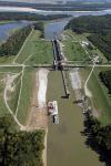
The locks keep the Atchafalaya and Mississippi Rivers from merging in a massive reconfiguration of a critical waterway.<br /><br />There was once a town called Torras, LA not far away. It was established in 1902 with great expectations due to its strategic location at the junction of the rivers and a co-located rail center. Ten years later the town’s levee on the Mississippi failed and decimated the young community. There was some effort to rebuild and it survived the Great Flood of 1927. It did not survive the relocation of the railroad. There are no buildings standing to show any such town ever existed.<br />
| | Attachments:
Locked Out
| | |
|
Gene Hammond - Dec 17,2011
Viewers
| Reply
|
| |
dan,
At first glance, I thought the long-told tale that the last lock and dam on the Mississippi was at St. Louis, but this picture would seem to indicate there are more further south. Further viewling would seem to indicate the lock is to provide an entrance to the Mississippi from another smaller river thus not on the Mississippi. P.S. I hate these travelogues because every time you post one, I spend hours tracing your flights on road maps and atlases. Don't stop!!!!!
| | |
|
Dan Nickens - Dec 17,2011
Viewers
| Reply
|
| |
Sorry about that, Gene. If I were more diligent I could save the Spot file with locations marked on Google Earth. That would require, however, that I get the postings done within the 30 days that they store the data. Or at least download the file it within 30 days. Or something. I'll work on the map thing.
| | |
|
Gene Hammond - Dec 18,2011
Viewers
| Reply
|
| |
Dan,<br /><br />I mant no criticism of your travelog - much appreciated. As for the maps, I relly enjoy perusing maps along your route. I've flownover much of this country, but never on the ground.
| | |
|
Dan Nickens - Dec 16,2011
Viewers
| Reply
|
| |
It has been postulated that the foundation the nation’s success rests on the broad shoulders of the Mississippi River. Witnessing the relentless flow of brown water it’s easy to believe.<br /><br />From the “The Geopolitics of the United States, Part 1: Inevitable Empire”, “The American geography is an impressive one. The Greater Mississippi Basin together with the Intracoastal Waterway has more kilometers of navigable internal waterways than the rest of the world combined. The American Midwest is both overlaid by this waterway, and is the world’s largest contiguous piece of farmland. The U.S. Atlantic Coast possesses more major ports than the rest of the Western Hemisphere combined. Two vast oceans insulated the United States from Asian and European powers, deserts separate the United States from Mexico to the south, while lakes and forests separate the population centers in Canada from those in the United States. The United States has capital, food surpluses and physical insulation in excess of every other country in the world by an exceedingly large margin. So like the Turks, the Americans are not important because of who they are, but because of where they live.” See the attached link for the full analysis.<br /><br />The False River Regional airport (HZR) at New Roads, LA provided a quick stop for self service fuel. Distance from Minton was only 180 miles, covered in 2.6 hours, for a sluggish average of 69 mph. Photos? 258 or 1.4 photo/mile.<br />
| | Attachments:
Stratfor Geographic Analysis: Inevitable Empire
| |
| Attachments:
Road to Greatness
| | |
|
Dan Nickens - Dec 16,2011
Viewers
| Reply
|
| |
The newly opened John James Audubon Bridge crosses the Mississippi River south of New Roads showing off its bright orange wires. It replaces a ferry that was put out of business by river flooding.
| | Attachments:

Bright Bridge
| | |
|
Dan Nickens - Dec 16,2011
Viewers
| Reply
|
| |
The big brown river is all about business.<br /><br />Some of that business is deadly serious. The pulp plant is located near a large island on the Mississippi known as Profit Island. The Profit Island Bend was the location of a horrific collision in 1837. A steamer (the Monmouth) hired by the U.S. Government to relocate 700 members of the Creek tribe from New Orleans to their reservation on the Arkansas River was headed upstream on the dark, rainy night of October 30. The steamer Warren was pulling the sailing ship Tremont downstream when they collided. The Monmouth sank immediately, taking with it 400 Creek men, women and children.<br /><br />Apparently navigating the river by steamboat was a risky venture. The boats going up stream were supposed to be in the slack current areas of the river (generally near the banks or the inside of curves). Downstream boats stayed in the middle of the channel or the outside of curves. Lights for night sailing were not required and searchlights weren’t available. At night the ships just weaved back and forth across the channel and hoped that they wouldn’t meet. The “Big River, little boat” theory was easily disproved by the disaster.<br /><br />'It is not without some feeling of indignation, that we mention the circumstance that the drowning of four hundred Indians, the largest number of human beings sacrificed in a steamboat disaster, attracted but little attention in any part of the country. Accordingly, the best accounts we have of the matter... have scarcely a single expression of rebuke for the heartless villains who want only exposed the lives of so many artless and confiding people to imminent peril, or almost certain destruction.' From Lloyds Steamboat Disasters, 1856.<br />
| | Attachments:
Wreck of the Monmouth
| |
| Attachments:

Pulp Plant
| | |
|
Dan Nickens - Dec 16,2011
Viewers
| Reply
|
| |
The ExxonMobile refinery in Baton Rouge is the second largest in the U.S. It processes more than 500,000 barrels of crude oil every day. AvGas is one of the many products produced at the plant. It keeps more than 2000 people employed and they keep Pia going.
| | Attachments:

Making Go Juice
| | |
|
Dan Nickens - Dec 16,2011
Viewers
| Reply
|
| |
The USS Kidd spends half the year in the water and half out. That’s because the river fluctuates more than 40’ between spring floods and winter droughts. Though named after Admiral Kidd (he died on the Arizona at Pearl Harbor), the crew of the destroyer adopted a pirate as their mascot (as in Captain Kidd). It earned the name of “Pirate of the Pacific” in World War II.
| | Attachments:

Half Docked
| | |
|
Dan Nickens - Dec 16,2011
Viewers
| Reply
|
| |
The Bayou Bengal Tiger stadium currently hosts the number one college football team.
| | Attachments:

Tiger Territory
| | |
|
Dan Nickens - Dec 16,2011
Viewers
| Reply
|
| |
The city ends and the swamps begin. It can get even swampier in floods. There were some big floods back in the 1970’s and 80’s. Several thousand homes got flooded costing $172 million dollars. The local government established a commission to come up with solutions. They did: flood gates, levees, and diversion canals costing hundreds of millions of dollars, more than the historic flood damage. They should finish up the flood mitigation efforts in the next six or seven years.<br /><br />Not everyone is happy, though: “I believe if they build that floodgate, they’re going to flood my butt,” said Jimmy Villar, 60. Jimmy should know. He lives along a part of Henderson Bayou known as Lake Villar. His house is at lake level. His butt is approximately two and half feet higher (according to local sources who admit they didn’t actually measure it).<br />
| | Attachments:

Seriously Swampy
| | |
|
Dan Nickens - Dec 16,2011
Viewers
| Reply
|
| |
Pass Manchac is the path between two large lakes, Lake Maurepas and Lake Ponchartrain. Lake Maurepas is a fresh water lake, but Lake Ponchartrain is really a tidal estuary (the second largest in the U.S. surpassed only by the Great Salt Lake). Both are shallow and perfectly suitable for Adventu'Reying.
| | Attachments:
Pair O Lakes
| | |
|
Dan Nickens - Dec 16,2011
Viewers
| Reply
|
| |
Having a tree rising up through the porch beats having to wade out and cut it down. Where’s the man of the house? Maybe ol’Hank Williams, Sr. knew:<br /><br />On the Banks of the Old Pontchartrain<br /><br />I travelled from Texas to old Louisanne <br />Through valleys, o'er mountains and plains <br />Both footsore and weary I rested awhile <br />On the banks of the old Pontchartrain. <br /><br />The fairest young maiden that I ever saw <br />Passed by as it started to rain <br />We both found a shelter beneath the same tree <br />On the banks of the old Pontchartrain. <br /><br />We hid from the shower an hour or so <br />She asked me how long I'd remain <br />I told her that I'd spend the rest of my days <br />On the banks of the old Pontchartrain. <br /><br />I just couldn't tell her that I ran away <br />From jail on a West Texas plain <br />I prayed in my heart I would never be found <br />On the banks of the old Pontchartrain. <br /><br />Then one day a man put his hand on my arm <br />And said I must go west again <br />I left her alone without saying goodbye <br />On the banks of the old Pontchartrain. <br /><br />Tonight as I sit here alone in my cell <br />I know that she's waiting in vain <br />I'm hoping and praying someday to return <br />On the banks of the old Pontchartrain...<br /><br />(Hank Williams - Ramona Vincent) <br /><br />
| | Attachments:

Lake Accommadation
| | |
|
Dan Nickens - Dec 16,2011
Viewers
| Reply
|
| |
Like its neighbor to the south (New Orleans), the Big Branch Marsh Wilderness waterfront was radically altered by Hurricane Katrina. Large areas of swamp grass (2400 acres) were converted to open lake. It’s a lot worse than that, according to Brad Del Rio, a local hunter. Many of the large oak trees would attract deer looking for acorn. Now a lot of oak trees and acorns have been blown away. The deer have to forage somewhere else. Brad usually bags two to three deer a season in the Big Branch Marsh, but he has not gotten a single one since Katrina. 'It can be very frustrating,' he said. 'Thank God the fish are biting.'
| | Attachments:

Big Marsh Lakefront
| | |
|
Dan Nickens - Dec 16,2011
Viewers
| Reply
|
| |
The fancy fan pad at NASA’s Stennis Space Center facility looks like it is rocket ready. It might, however, be a relic of one of the towns that were relocated to make room for the rockets. Gainesville, Logtown, Napoleon, Santa Rosa and Westonia were all victims of the space race.<br /><br />In 1961 the Mississippi site was selected to test moon rocket motors. The cited reason for its selection was the 125,000 acre sound buffer of undeveloped land (excepting only the towns that were dozed over). The reality of its selection is more likely related to some politician’s fat pockets. Nevertheless, in the 60’s and 70’s it was said, “If you want to go to the moon, you first have to go through Hancock County, Mississippi.” And, I might add, “If you want to go to Florida from California, you might as well bypass Hancock County because it is a Restricted Area.”<br />
| | Attachments:

Fan Pad
| | |
|
Dan Nickens - Dec 16,2011
Viewers
| Reply
|
| |
Saturn V and Space Shuttle engines were flight certified at the Stennis Space Center test facilities.
| | Attachments:

Rocket Ready
| | |
|
Dan Nickens - Dec 16,2011
Viewers
| Reply
|
| |
The bright white sand of the Wolf River east of the Stennis Space Center made a squiggly path down to the Gulf.
| | Attachments:

Sand Strewn Stream
| | |
|
Dan Nickens - Dec 16,2011
Viewers
| Reply
|
| |
Calling a pulp plant treatment pond “water” is a bit generous. Watery is a better description. There might be something leaking into the drinking water, however, because one of the all time great professional quarterbacks grew up nearby. Kiln, Mississippi is the hometown of Brett Favre,
| | Attachments:

Water Cells
| | |
|
Dan Nickens - Dec 16,2011
Viewers
| Reply
|
| |
Out on the bay at the end of the day two vastly different ships crossed paths. I wonder if life on the water is as good as life above it. And I wonder about all the earthly lives that can be crossed over in one SeaRey day. How many people looked up and wondered about the little gray airplane passing overhead? I know it’s a wonder looking at all the earthly goings on below as we flew past.
| | Attachments:

Mobile Shipping
| | |
|
Don Maxwell - Dec 16,2011
Viewers
| Reply
|
| |
Dan, her sister gets up here on the James River:<br /><br />And look at the lifeboat that both sisters carry:
| | Attachments:

IMG 7521
| |
| Attachments:

IMG 7525
| | |
|
Dan Nickens - Dec 16,2011
Viewers
| Reply
|
| |
The sun was rapidly slipping away. The closest stop was the Jack Edwards airport (KJKA). The statistics for the last leg of Pia’s day included 2.9 flight hours for 246 miles (85 mph) and pictures 209, or less than 1 per mile (a sure sign of getting back towards home grounds?). After 8.5 hours in the air in one day I was too tired to grasp the enormity of all the lives we passed over.
| | Attachments:

Slip Sliding Away
| | |
|
Dave Edward - Dec 17,2011
Viewers
| Reply
|
| |
Another great saga Dan ! Lynn asked 'what have you got the atlas out for ?'. Keep these traveloges coming please......and Thank You.
| | |
|
|
|
|
|
|
|
|
|
|
|
| |
- About Searey.us -
- Contact Searey.us -
|
- Privacy Statement -
- Terms of service -
|
Copyright © 2024 Searey.us & Brevard Web Pro, Inc. -
Copyrights may also be reserved
by posters and used by license on this site. See Terms of Service for more information.
|
| |
- Please visit our NEW
Chapter Place Website at: chapterplace.com or
Free Chapter Management Website at: ourchapter.org. Good for all chapters, groups or families. |
| | | | | | | | | | | | | | | | | | | | | | | | | | | | | | | | | | | | | | | | | | | | | | | | | | | | | | | | | | |